Welcome to the Alabama Statewide Transportation Plan (SWTP) update forecasting thru year 2050.
We would like to thank you in advance for your participation. Together, we can build a transportation system that meets the needs of all Alabamians now and in the future.
Please check back periodically for updates to our webpage.
The Statewide Transportation Plan is a long-range plan that assesses the State’s multimodal transportation system and presents plans for improvement and maintenance. The plan will forecast a minimum of 20 years, and will involve engagement with both public and private entities. The plan is designed to meet the goals and other requirements required by federal legislation, including the new FAST Act with its emphasis on performance management.
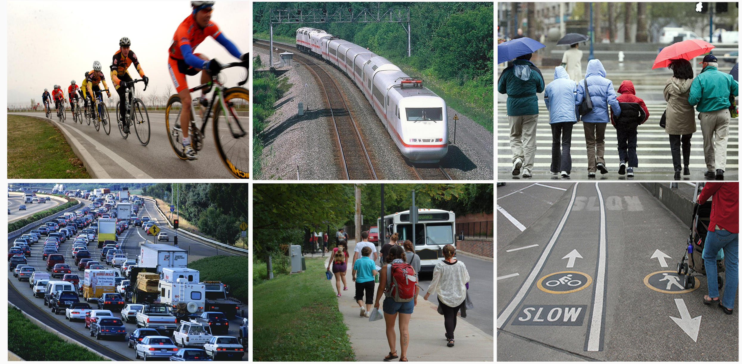
The Statewide Transportation Plan will include both a document and a travel demand model. The document will provide a means to display the State’s current assets and examine where work will be needed in the future. The travel demand model will be used to forecast traffic to help identify future needs. Alabama’s transportation infrastructure includes the highway system, transit and rail lines, bicycle and pedestrian operations, freight operations, airports, and river and seaports.
This website will continue to be update periodically. The most recent Statewide Transportation Plan was completed in July 2017. This report is available below in the Reports Tab. Deliverables included interim reports, mapping, and other related information. The previous statewide transportation plan (2008) is available here. An assessment of the existing transportation system was also performed in 2008 and that document is available here.
Your comments are important to us - please continue to let us know about transportation related concerns that you think will help us to improve the Alabama transportation program. Please send your comments to: aldotstatewideplanning@dot.state.al.us.
Alabama’s highway network provides connectivity for passenger vehicles as well as goods and services. Roadways are described by the federal functional classification system, which defines a roadway based on its accessibility and mobility. Interstates provide the most mobility, while local roads provide the most accessibility. ALDOT uses a number of tools to determine the future highway needs of the State, such tools include the ALGO Traffic Incident Management System, the MPO travel demand model, and various local and statewide transportation plans.
Rail exists in Alabama for the purpose of moving passengers and freight. Amtrak is the major mover of passengers and there are four class 1 railroads operating in Alabama. The Alabama Department of Transportation looks at rail movement from several angles. There is the need to understand freight movement and the major generators of that freight movement. Safety planners also need to monitor rail grade crossings to examine the potential for accidents.
Airports are important to Alabama passenger and freight movements. Alabama’s airport system consists of over 200 registered airports, 6 of which have commercial services. The State Aeronautic Bureau maintains an Airport System Plan, which inventories the current condition of the network.
Alabama has approximately 1,500 miles of navigable inland waterways along six corridors, giving it one of the longest such systems in the United States. These water corridors connect to over 15,000 miles of inland waterways in 23 states via the Tennessee-Tombigbee Waterway and the Gulf Intracoastal Waterway. ALDOT’s role in improving the movement of waterborne freight consists of ensuring the efficient access to and from port and dock facilities.
Approximately 55 of 67 counties have public transit operations in Alabama. ALDOT responsibilities for transit are specified in state and federal law and include planning as well as capital and operating funds grant program management and administration. Transit systems in the state also rely on Metropolitan Planning Organizations and Regional Planning Commissions to assist with reporting and meeting state and federal requirements.
Current transportation legislation continues to place an emphasis on bicycle and pedestrian modes of travel. This has been recognized by the Alabama Department of Transportation as they are developing a Statewide Bicycle and Pedestrian Plan. Many cities have followed suit with their own bicycle and pedestrian plans.
 Presentation
 Agenda Schedule Fact Sheet Blank Comment Form Presentation Schedule Stakeholder Listing Verbal Comments Questionnaire Comments Presentation Agenda Minutes Data Needs
The Statewide Transportation Plan (SWTP) is the result of the statewide planning process that reviews long range transportation needs in the state, seeks public input on priorities of stakeholders and communities, evaluates funding resources and develops recommendations for programs, policies and transportation initiatives.
It is important to maintain oversight of the condition and operation of transportation programs so that the State is able to respond to evolving transportation demands. As the State grows and businesses establish themselves in Alabama, the Department's goal is to provide mobility that facilitates access to jobs, education, commerce and other trip purposes.
The SWTP is also a federal requirement in order to maintain eligibility for federal funds. Transportation projects will usually require years of preparation to accomplish. The SWTP looks ahead to identify emerging needs and evaluate how best to meet the transportation needs of citizens. Projects included in the STIP should be in keeping with the needs identified in the SWTP.
The SWTP is multimodal and includes roads and bridges, transit, bicycle, pedestrian, freight transportation, passenger rail and aviation activities. Federal regulations emphasize safety and security; the SWTP will look carefully at the safety and security of different transportation modes.
The study will have ample opportunity for citizens to participate through public meetings, reviewing materials on the web and providing comments. You can send in comments via mail, e-mail, or in person at meetings. You can stay involved through materials posted to the web, by attending public meetings and by communicating with the study team.
The FAST Act and FHWA continue to strengthen the role of Indian Tribes in the transportation planning process. Transportation plans shall be developed in consultation with the tribal government and the Secretary of the Interior. FHWA recently convened a rulemaking committee for the Tribal Transportation Self-Governance Program (TTSGP) in order to develop a detailed interpretation of how and when Indian Tribes should be fully involved in federal processes and programs. In the meantime, ALDOT is continuing its efforts towards more fully incorporating the Indian Tribes into its planning processes. For the Statewide Transportation Plan, ALDOT is coordinating to receive relevant transportation and socioeconomic data and information, particularly with regard to travel demand modeling and projected growth.
The State of Alabama recognizes nine Indian Tribes: Poarch Band of Creek Indians, Echota Cherokee Tribe of Alabama, Cherokee Tribe of Northeast Alabama, Ma-Chis Lower Creek Indian Tribe of Alabama, Southeastern Mvskoke Nation, Cher-O-Creek Intra Tribal Indians, MOWA Band of Choctaw Indians, Piqua Shawnee Tribe, and United Cherokee Ani-Yun-Wiya Nation. One is also federally recognized: the Poarch Band of Creek Indians.
The Statewide Transportation Plan is a long-range planning document looking 20 years or more into the future. The Statewide Transportation Plan is not required to include specific projects but will provide a plan to improve and maintain the State’s current assets. The Statewide Transportation Improvement Program (STIP) identifies multimodal transportation projects across the state for a four year period. The STIP includes all projects inside the Metropolitan Planning Organization’s TIP, as well as projects in the rural and small urban areas. The STIP is financially constrained, meaning there are sufficient funds available to complete the four-year program of projects.
A statewide model will be developed to provide projected traffic volumes, as well as to identify anticipated locations of congestion and need for improvements. The model reflects base year 2010 and future year 2040 growth and is based on readily available data. The model platform is CUBE Voyager.
The model process is initiated with assessment of current conditions. Traffic Analysis Zone (TAZ) boundaries are defined through a review of Census data, MPO models, and previous ALDOT evaluations of transportation conditions. The trip generation module uses base year socioeconomic data (population, households, employment, household median income, and automobile ownership) to determine the number of trips made between TAZs.
Following development of the trip generation module, a base year roadway network will be developed to include all Interstates, U.S. Routes, and State Routes. Trips are assigned to the network based on the simplest path between an origin and a destination. By running the base year model, an estimate of the total number of vehicles using each roadway in the network will be developed. When compared to the roadway capacity, the model identifies congested areas and shows the level of congestion projected to occur.
The base year model is calibrated and validated to FHWA specifications provided in the Model Calibration and Reasonableness Checking Manual. Calibration and validation of the base year model ensures it accurately reflects current travel patterns and traffic volumes, thereby providing confidence in the model and its ability to reflect current as well as future conditions. After approval of the base year model, the future year model is developed to project future conditions and determine the transportation network’s future performance.
Your comments are important. Please contact us with your ideas, concerns, and thoughts regarding the Statewide Transportation Plan update.
Household Distribution, 2010This map depicts the concentrations of households across Alabama.
Employment Concentration, 2010This map depicts the concentrations of employment across Alabama.
Projected Household Growth, 2010 – 2040This map depicts the projected household growth by census tract across Alabama.
Projected Employment Growth, 2010 – 2040This map depicts the projected employment growth by census tract across Alabama.
Alabama MPOs and RPOs
This map depicts the locations of Metropolitan Planning Organizations and Rural Planning Organizations.
A Metropolitan Planning Organization is a group of representatives from local governments that come together
to address transportation issues is their jurisdictions ( MPO Websites).
A Rural Planning Organization address the same issues in rural populations across the state. Rural Planning
Organizations are staffed by Councils of Government; more information is available at https://alarc.org/.
Major Capacity Improvements Committed Through 2040Projects were determined based on cost, location, and criticality to the network. This is not an all-inclusive list. The most up to date project listing rests with the Statewide Transportation Improvement Program, which provides information on cost, project dates, etc. for projects in a 5 year window.
Key Bridge Projects
This map depicts bridge projects of significance across Alabama. Projects were determined based on cost, location, and criticality to the network. This is not an all-inclusive list. The most up to date project listing rests with the
Statewide Transportation Improvement Program, which provides information on cost, project dates, etc. for projects in a 5 year window.
Key Resurfacing and Pavement Rehabilitation Projects
This map depicts maintenance projects of significance across Alabama. Projects were determined based on cost, location, and criticality to the network. This is not an all-inclusive list. The most up to date project listing rests with the Statewide Transportation Improvement Program, which provides information on cost, project dates, etc. for projects in a 5 year window.
Transit Services
This map depicts the various fixed route and demand-response transit systems across the state. This map also indicates which populations have access to public transit service within their county.
Ports, Airports, and Intermodal Facilities
The ability to safely and efficiently move goods across the state is an essential function of the transportation system. Alabama’s ports and airports move goods and services into and out of the state, as well as the country, and interact with the highway and rail systems through numerous intermodal centers.
Hurricane Evacuation Routes
This map depicts the various state, U.S., and interstate highways that have been designated as evacuation routes by the State of Alabama.
More information on those designations can be found at
I-65 Reverse Laning.
Existing Traffic Volumes
Traffic volumes are collected by the Alabama Department of Transportation. ALDOT’s Traffic Section uses ATRS, electronic strips, and other technology, along with manual counts, to determine daily and hourly traffic.
Existing Congestion
FHWA defines a bottleneck as a localized section of highway that experiences reduced speeds and inherent delays due to a recurring operational influence or a nonrecurring impacting event. The below maps reflect bottlenecks in a number of the urbanized areas.
Projected Traffic Volumes
Traffic Volumes are projected using a travel demand model. ALDOT currently uses CUBE Voyager to develop a base model and project that traffic out to the year 2040. More information about travel demand modeling can be found in the Frequently Asked Questions section.
Projected Congestion
Projected congestion is dependent on a number of factors, including the movement of the residential population and the rise and fall of employment centers. This map will show projected 2040 congestion based on the 2040 travel demand model.
Projected Congestion – Build Scenario
ALDOT has committed to build a number of projects in the years encompassed by this Statewide Transportation Plan. This map reflects traffic congestion considering the projects that are currently slated to begin work before the year 2040, which is the time period for ALDOT’s long range plan.
For questions pertaining to the Statewide Transportation Plan contact Office Engineer, Planning Studies at 334.242.6085.
 The Statewide Transportation Plan is a long-range plan that assesses the State’s multimodal transportation system and presents plans for improvement and maintenance. The plan will forecast a minimum of 20 years, and will involve engagement with both public and private entities. The plan is designed to meet the goals and other requirements required by federal legislation, including the new FAST Act with its emphasis on performance management.